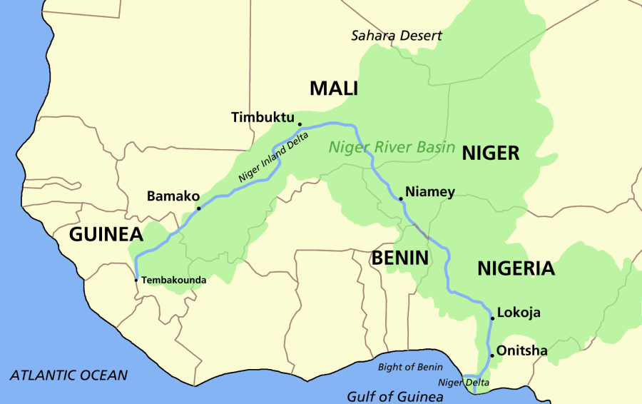
The Niger River is a unique, curved river whose 2,600-mile journey passes through five countries on its way from the Guinean highlands to the Atlantic. While this river gives its name to two countries – Niger and Nigeria – its own name, like those of Egypt and the Nile, was actually bestowed by the Ancient Greeks. There are numerous indigenous names for the river, however, including the Tuareg name, egerou n-igereou, or “river of rivers.”
The River’s Course
The source of the Nier is actually only 150 miles inland from the Atlantic, in the highlands of Guinea. From there it flows in a northeasterly direction, through the Sahel and into the Sahara, past Timbuktu before curving abruptly southward and making for the ocean in the Gulf of Guinea. The unique shape of the river’s course has earned it the moniker Boomerang River.[1] The preeminent river of West Africa, the Niger’s river basin sprawls through ten countries, reaching as far north as Algeria and east into Chad. A life-giving source for the desert areas through which it flows, the river loses nearly two-thirds of its water due to evaporation and seepage in those arid climes. In fact, in the 1980s parts of the river dried up completely! Not even the Benue River, the Niger’s most prominent tributary, can compensate for all of the moisture lost to the desert.
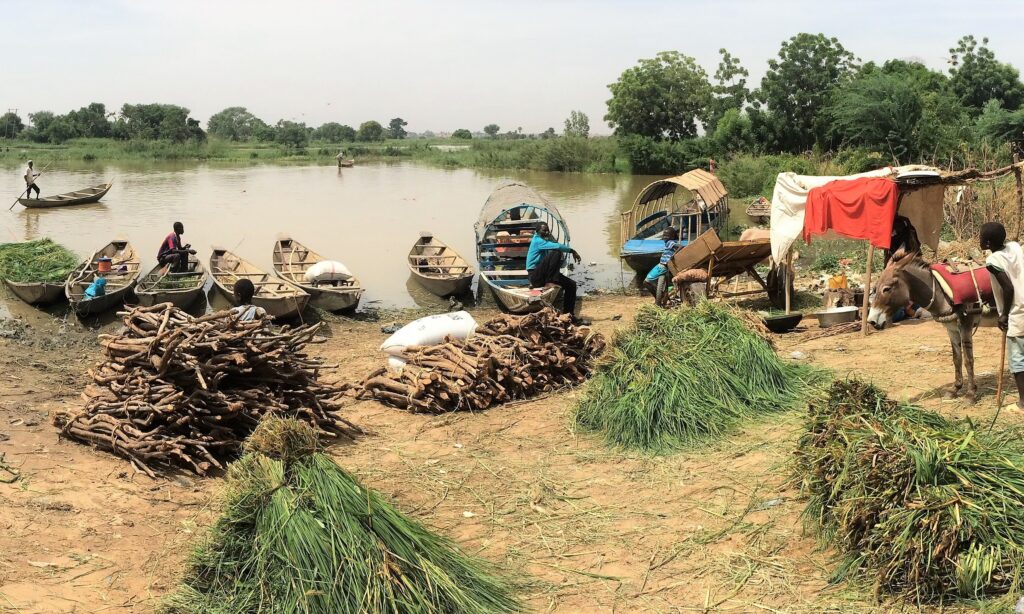
The river’s course takes it through a remarkable span of habitats, from its beginning in the densely wooded mountains of Guinea, through Sahel and Sahara, even swamps. The northern stretch of the river, before the sudden southern bend, is a vital water source in the Sahel and desert. In these dry areas the river and its floods provide resources for farming, grazing, and fishing. After the bend, the Niger pours into more humid areas of grassy savanna and the rainforest belt. As the river finally reaches its destination, it flares into a massive delta, where it mingles with the marshy mangrove swamps of Nigeria’s shoreline.
Deltas
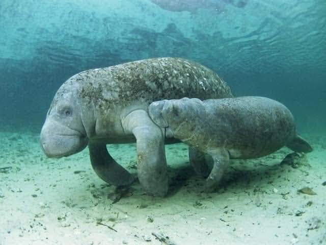
The Niger might only be Africa’s third largest river (after the Congo and the Nile), but it has the largest delta in the world. The delta boasts some of Africa’s most abundant mangrove forests and is host to abundant wetland wildlife such as the African Manatee. Tragically, the area is also home to vast fossil fuel reserves and has suffered numerous oil spills. In fact, according to Amnesty International, The Niger Delta is one of the most polluted places on earth.
Want to Know More about Nigeria’s Unique Geography?
Check out This Article!
Not only does the Niger have the world’s largest delta, but did you know that this river actually has two deltas? As the river leaves the highlands and pours into the dry, desert areas, it fans into a web of streams and swamps in a vast area known as the inland delta. Highly dependent on the river’s annual floods, it is an area of fluvial wetlands, lakes, and floodplains, a fertile jewel in the semi-arid Sahel.[2]
Importance of The Niger River
The Niger River has been the most important water source in the western Sahara for thousands of years. One of the world’s most productive wetlands, the seasonal floods has supported fisheries, pasture, and farming for much of history. A key component of trans-Saharan trade, the river has been instrumental in the rise of empires such as the Songhai Empire, one of the largest African empires in history.[3]
The Niger River embodies the livelihoods and geopolitics of the nations it crosses. This river is not simply water, but is also an origin of identity, a route for migration and commerce, a source of potential conflict, and a catalyst for cooperation.
– World Bank, The Niger River Basin: A Vision for Sustainable Management
Today, more than a million people continue to depend on resources just from the inland delta.[4] 100 million live within the Niger River Basin.[5] The Niger also remains an important mode of transportation, while dams facilitate hydro-electric power and irrigation. Sadly, deforestation, pollution, climate change, and deforestation are all taking their toll on this unique river and its ecosystems.
Want to Know More?
Check out this WWF Publication!
[1] https://www.worldatlas.com/articles/where-does-the-niger-river-flow.html
[2] https://eol.jsc.nasa.gov/Collections/EarthObservatory/articles/InlandDeltaoftheNigerRiver.htm
[3] https://en.wikipedia.org/wiki/Niger_River
[4] https://eros.usgs.gov/earthshots/inland-delta-of-the-niger-river-mali
[5] https://documents1.worldbank.org/curated/en/187941468097179065/pdf/345180PAPER0NR1Basin01OFFICIAL0USE1.pdf