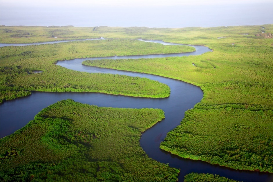
The Gambia River flows through 700 miles of savannah, forest, and mangrove swamp before reaching the Atlantic.
The Gambia River
Africa is home to several impressive rivers: The Nile, the longest river in the world is also uniquely north-flowing; the Congo is the deepest river in the world; and the Okavango, whose unique inland delta is one of Africa’s Seven Natural Wonders, to name a few.[1] The Gambia River is the last undammed river in West Africa and the lifeblood of The Gambia. Its fertile floodplains offer ideal conditions for agriculture; its waters are abundant with fish; its current has facilitated transportation to vibrant trade networks for centuries. Today, river excursions are a popular tourist activity that explore the country’s abundant natural beauty, wildlife, and history. In fact, the World Wildlife Fund lists The Gambia River as one of the 200 most biologically valuable resources of the Earth!
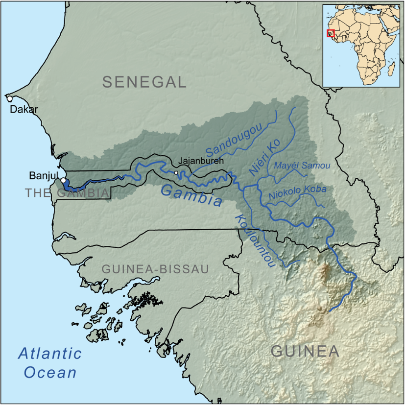
Did you know that the Gambia River does not actually begin in The Gambia? Over 700 miles away from Banjul, where it pours into the sea, the river springs forth in northern Guinea. Nearly half of the river is navigable, including all of the lower section that flows through The Gambia.
The River
From bubbling spring to massive river eight miles wide at the mouth, the Gambia River winds its way through several diverse landscapes. The river itself is dominated by two basic regions, brackish tidal waters and fresh upriver waters.
Brackish Habitats
The wide mouth of the Gambia River is dominated by brackish tides and riverside mud flats that extend some 60 miles upriver. Here creeks (known locally as bolongs) twist their way about, dotting the river with islands. The largest of these is Kunta Kinteh, but others include Elephant and MacCarthy Islands.
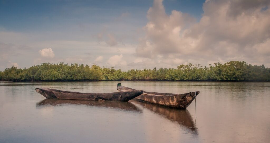
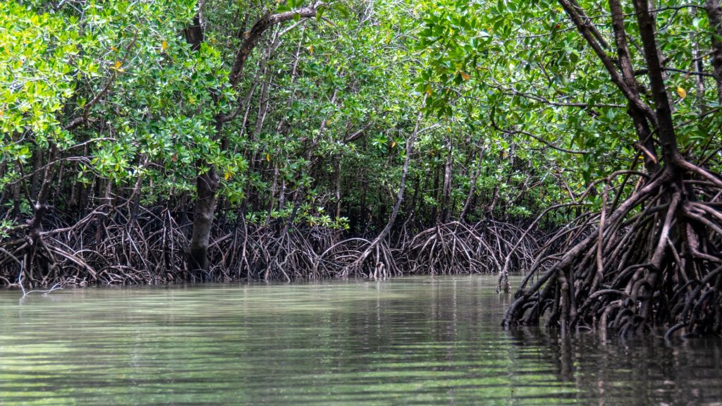
Mangroves thrive in these brackish waters. In fact, there are 111,000 acres of mangrove swamp in The Gambia. The forests are thriving ecosystems. Fish spawn among the trees before continuing on to the sea, providing fishermen with their livelihood. Women, too, earn their livelihood in these forests. In fact, at the mouth of the river is one of the country’s main oyster production areas at Tanbi Wetlands National Park.
Want to Know More?
Check out this FAO Fact Sheet!
Transition
Banto faros are grass-covered river flats. These areas are periodically inundated with brackish tidal waters. Recent climate change has affected the area as rising ocean levels push these saltwater tides farther and farther upriver, causing devastation to local farmers as crops fail.
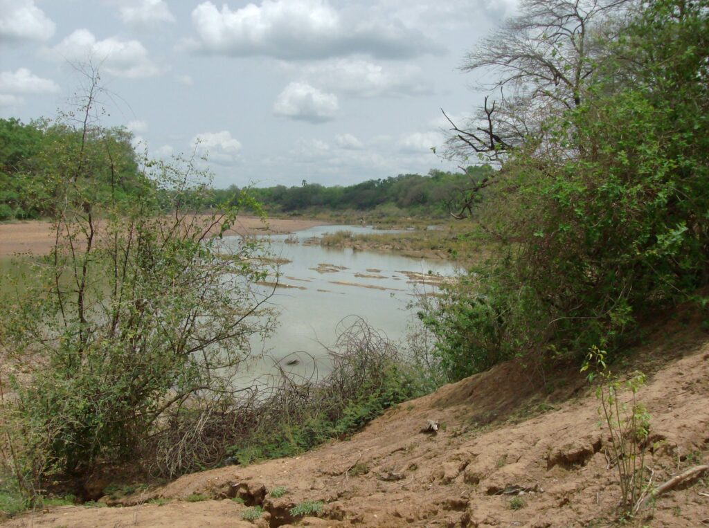
Freshwater Habitats
The tidal saltwaters wane upriver. Seasonal flooding due to heavy rains from June to October supports most of The Gambia’s agriculture. Sadly, even in areas beyond the invading saltwater have been devastated by the lack of rain in recent years.
Beyond The Gambia
The river flows through three countries. It emerges as a spring from the mountainous terrain of the Fouta Djallon plateau in Guinea. From here it winds through the savannahs and forests of the Niokola-Koba National Park and Barrakunda Falls in Senegal before emerging into The Gambia.
Want to know more?
Explore the Gambia River through World Atlas!
Meet Jason Florio and his wife Helen Jones-Florio,
who followed the Gambia River from its source to its mouth!
[1] https://www.worldatlas.com/rivers/10-longest-rivers-in-africa.html