Nigeria has a rather astonishing array of landscapes in its 356,669 square miles, from arid savanna in the north to swamps in the south.[1] In fact, did you know that in this one country, there are four climate types?
North: Savanna
Northern Nigeria is hot and dry. Mostly grass with a smattering of trees and shrubs, the farther north, the drier the climate. The most extreme area is the northeastern tip, where the country extends into the Sahel and rain is scarce. In this region, few trees remain and sand creeps in among the grass. These areas are generally used for hardy agriculture and animal husbandry.
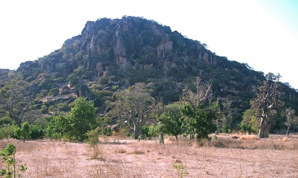
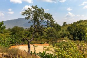
Central: Highlands and Savanna
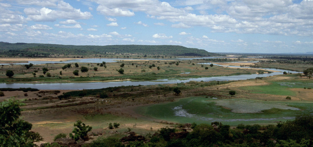
Nigeria is bisected by two rivers, the Niger and Benue, its main tributary. In fact, the Niger’s river basin extends not only across the middle of Nigeria, it sprawls through nine further Sub-Saharan countries.
Around these rivers, near the center of Nigeria, a collection of hilly mountains and plateaus make a highland region. The tallest areas – such as Obudu Plateau which stands 5,630 feet above sea level – are even high enough that, in spite of being in the tropics, they experience a cool, temperate climate. Besides agriculture, there is a great deal of mining, especially tin mining, in the area.
This large area across the center of Nigeria is characterized by two distinct seasons: rainy (monsoons), and dry. With considerably more rain than the more northern region, vegetation becomes more abundant the farther south, where the nation’s most abundant agriculture takes place.
South: Rainforest
The southern, lowland part of Nigeria is all about the humidity. In fact, there are two rainy seasons – the first from March to June, then a second in September. Characterized by its dense foliage and numerous animal species, the forests that cover this region fade from mixed deciduous to rainforest as it drifts southward. In fact, the region is a major producer of hardwoods such as mahogany and African teak, which continues to take its toll on many of the forests. That being said, the still-lush landscape, with its abundance of flora and fauna – some of which is only found in these forests – attracts a considerable amount of tourism to Nigeria. As an area with rich soil, one major threat is agricultural deforestation, especially for growing cash crops such as cocoa and rubber. Yet preservation of these rainforests is vastly important in the face of climate change, as research has indicated that African forests actually store more carbon than those of the Amazon.
Bonus! Wetlands and Coast
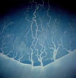
The southernmost coastal area of Nigeria is dominated by wetlands. The Niger Delta is the largest in the world, and it seeps into freshwater swamps before giving way to brackish mangrove swamps and tidal flats. Oil has been pumped in the area since the 1950s – first at Bayelsa by Shell in 1956. Now, the area is the biggest producer of petroleum in West Africa, and accounts for more than 75% of Nigeria’s export earnings[2]. Oil production in the region is a major pollution in the form of greenhouse gas emissions from burn off as well as oil spills – in fact, the delta suffers some 10.5 million gallons of oil spilled every year.
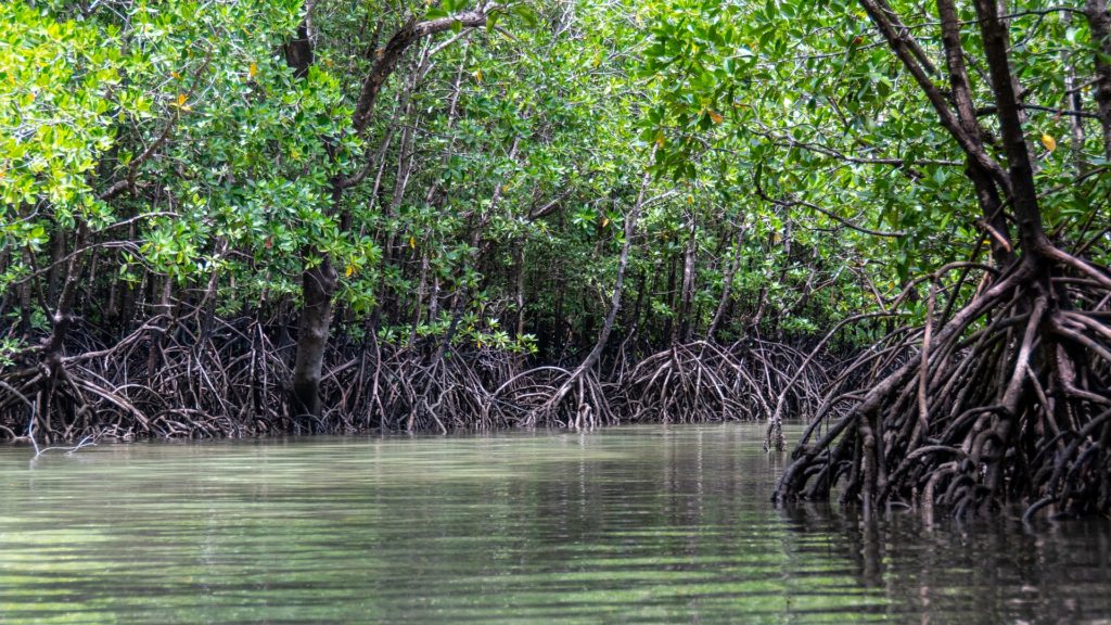
Mangrove forests are swampy woodlands that thrive in tropical areas where riverbanks meet the sea. With the Niger Delta dominating the coast, it should come as little surprise that the Nigerian mangroves are the largest in all of Africa – in fact, they are the third largest in the world.[3] Sadly, like the majority of the Delta region, they are currently in danger due to the high levels of industrial pollution and oil production.
Brackish mangrove swamps are not the only landscape found along Nigeria’s coast, however. In fact, the coast is scattered with beaches, even in the delta region. The more popular, developed beaches are in the west, however, near Lagos, where resorts, clubs, and music cater to fun-seeking crowds. Wildlife, culture, and natural beauty draws hundreds of thousands of tourists to Nigeria each year – will you be among them?
Resources:
Nigeria Maps & Facts – World Atlas
[1] https://www.worldatlas.com/maps/nigeria
[2] https://en.wikipedia.org/wiki/Niger_Delta
[3] https://www.researchgate.net/publication/353015011_MANGROVE_FORESTS_IN_NIGERIA_WHY_THEIR_RESTORATION_REHABILITATION_AND_CONSERVATION_MATTERS